
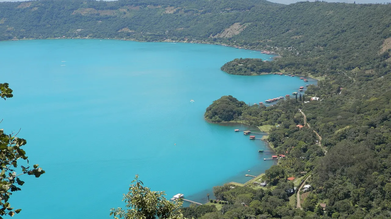
Lake Coatepeque, El Salvador
At a glance
| Lake Coatepeque | |
|---|---|
| Department | Santa Ana |
| Altitude | 745 m |
| Caldera | 6.5 × 11.5 km |
| Islands | Isla Teopán (Cerro Grande), a lava dome |
| Protection | Protected natural reserve since 17 February 2023 |
Source: El Diario de Hoy: the six main protected areas of El Salvador, 2025; Smithsonian Global Volcanism Program: Coatepeque Caldera1,2
Map
- 1 Lake Coatepeque Caldera lake, 25.3 km²
- 2 Santa Ana volcano 2,381 m; last eruption 2005
- 3 Izalco volcano 1,950 m; last eruption 1966
- 4 Lake Ilopango Caldera lake, 72 km²
- 5 Lake Suchitlán Reservoir of the Cerrón Grande dam
- 6 El Imposible National Park About 4,977 ha of forest
- 7 Los Volcanes National Park (Cerro Verde) Cerro Verde, Santa Ana and Izalco
- 8 El Boquerón National Park The crater of the San Salvador volcano
The caldera
- How it formed: the 6.5 by 11.5 km caldera collapsed during large explosive eruptions between about 72,000 and 51,000 years ago. Its western rim meets the flank of the Santa Ana volcano.
- Domes and hot springs: later lava domes form the island and the peninsulas of the eastern shore; the youngest, Cerro Pacho, is thought to be less than 10,000 years old. Hot springs rise near the shore. No eruption has been verified.
Source: Smithsonian Global Volcanism Program: Coatepeque Caldera2
Visiting
Visitors dive, kayak and swim in the lake; the Laguna de Manguitos is also part of the reserve.1
For investors
Lakeside land sits inside a protected natural reserve and a volcanic caldera. Before buying or building, check the rules of the reserve with the Ministry of Environment and ask your engineer about slope and seismic risks.
Sources
- El Diario de Hoy: the six main protected areas of El Salvador, 2025 (in Spanish)
- Smithsonian Global Volcanism Program: Coatepeque Caldera
- Smithsonian Global Volcanism Program: Santa Ana
Figures checked 9 November 2026. Prepared by InvestSalvador.com for general information. Figures come from the sources listed.